
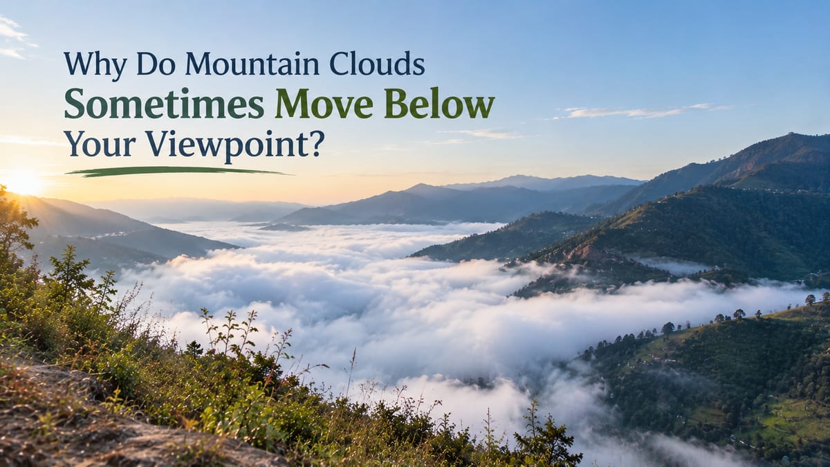
Why Do Mountain Clouds Sometimes Move Below Your Viewpoint?
Mountain clouds can create some of the most breathtaking views in the hills. Imagine standing on a mountain early in the morning. The air is cool, the landscape stretches into the distance, and a thick blanket of white clouds fills the valley below. Instead of looking up at the clouds, you find yourself looking down at them. They drift slowly between the hills, hiding forests, winding roads, and entire villages beneath a soft layer of white.
It almost feels as though you are standing above the sky.
This beautiful natural phenomenon is often called a sea of clouds. Although it may seem unusual, there is a scientific explanation for why clouds sometimes appear below mountain viewpoints. The secret lies in moisture, temperature, elevation, and the way air moves through mountain landscapes.
Understanding these conditions makes the experience even more fascinating.
Why Do Mountain Clouds Sometimes Appear Below Mountains?
Clouds appear below a mountain viewpoint when moist air cools enough for water vapour to condense into tiny water droplets or ice crystals at an elevation lower than the observer.
Clouds do not form at one fixed height. Their position depends on atmospheric conditions, including temperature, humidity, air pressure, and the movement of air.
When you stand on a mountain above a layer of clouds, you are seeing the top of a cloud layer that has formed lower down. The clouds may fill a valley or spread across a broad area of low-lying land, creating the impression of a white ocean beneath the surrounding peaks.
From the valley floor, the same scene might look completely different. Someone standing below could find themselves surrounded by mist or fog, while someone on a nearby ridge enjoys clear skies and sunshine.
The difference is largely a matter of elevation.
How Do Clouds Form in Mountainous Areas?
To understand why clouds gather below mountain peaks, it helps to know how clouds form in the first place.
Moist Air and Cooling Temperatures
Air naturally contains water vapour, although the amount varies with temperature and humidity. When moist air cools to its dew point, water vapour can condense onto tiny particles in the atmosphere, such as dust or salt, forming cloud droplets.
Mountains play an important role in this process.
When winds carry moist air towards a mountain range, the air may be forced to rise along the slopes. As it rises, atmospheric pressure decreases, causing the air to expand and cool. If it cools sufficiently, clouds can develop.
This process is known as orographic cloud formation.
It explains why mountain slopes and peaks are sometimes surrounded by clouds, particularly when moist winds move towards the mountains.
However, not every cloud beneath a mountain forms this way. A sea of clouds can also develop when moisture becomes trapped in valleys, especially under stable atmospheric conditions.
What Is a Sea of Clouds?
A sea of clouds is a breathtaking sight in which an extensive layer of clouds covers the landscape below, leaving mountain peaks and ridges rising above it like islands.
The effect can be especially striking at sunrise, when changing light illuminates the cloud tops while the valleys remain hidden.
Despite its name, a sea of clouds is not a separate type of cloud. It is a visual description of a broad cloud layer viewed from above.
Such scenes commonly involve low-level clouds, including stratus clouds, which form relatively uniform layers. In some cases, fog fills the valleys below the observer.
The distinction between fog and clouds is mainly about where they occur. Fog is essentially a cloud at ground level, so a valley covered in fog can look like a sea of clouds when viewed from a higher elevation.
Why Do Clouds Fill Valleys First?
Valleys can provide favourable conditions for low clouds and fog, particularly during calm, cool nights.
After sunset, the ground loses heat. The air in contact with the cooling surface may also become colder. If it cools to its dew point, moisture condenses and fog develops.
When the valley is sheltered from strong winds, this cool, moist air may remain in place for hours.
From a higher viewpoint, the fog can form a relatively continuous layer across the valley floor. Nearby ridges remain visible above it, creating the familiar sea-of-clouds effect.
This is one reason early mornings can offer particularly memorable mountain scenery. However, the phenomenon depends on the weather, and it is never guaranteed at a particular location or time.
The Role of Temperature Inversions
One of the most important atmospheric conditions associated with clouds below mountain viewpoints is a temperature inversion.
Normally, air temperature decreases with increasing altitude through much of the lower atmosphere. During a temperature inversion, a layer of air becomes warmer with height rather than colder.
This can happen in valleys when the ground cools rapidly overnight. The air near the valley floor becomes colder, while the air above remains relatively warm.
The resulting arrangement can limit vertical air movement and help keep cool, moist air trapped near the ground.
If enough moisture is present, fog or low clouds may form within this cool layer.
How Does an Inversion Create a Sea of Clouds?
Picture a mountain valley on a clear, calm night.
As the ground loses heat, cold air gathers in the lower areas. Warmer air sits above it, creating a stable atmospheric arrangement. Moisture within the cool air condenses, and fog begins to spread through the valley.
By morning, the valley may be hidden beneath a thick layer of white cloud, while the mountain slopes above the inversion remain sunny and clear.
From a viewpoint high enough to rise above the cloud layer, you can look down on this scene.
It is important to understand that a temperature inversion does not automatically create clouds. Moisture must also be present, and the temperature must be suitable for condensation. An inversion can help preserve existing fog or low clouds, but the exact outcome depends on local weather conditions.
Why Do Mountain Clouds Sometimes Move?
Clouds can appear to move across a valley even when the surrounding mountains remain perfectly still. Their movement is mainly caused by wind and changes in atmospheric conditions.
Wind carries clouds from one area to another. When air flows through narrow valleys or around mountain ridges, the surrounding terrain can influence its speed and direction. As a result, clouds may drift in unexpected directions or appear to flow between peaks.
Sometimes, the cloud layer also changes shape as moisture evaporates in one area and condenses in another. This can make clouds seem to roll, rise, or disappear as you watch them.
There is another interesting detail: clouds can appear stationary even when the air is moving through them. As moist air enters a suitable area and forms cloud droplets, air leaving that area may become warmer or drier, causing droplets to evaporate. The cloud appears to stay in place even though the air and water droplets within it are continually changing.
This is why mountain clouds can look like a flowing river, a moving blanket, or waves travelling across a white ocean.
When Is the Best Time to See Clouds Below Mountain Viewpoints?
Although cloud formations can occur throughout the year, certain weather conditions make the sea-of-clouds effect more likely.
Early morning: Clear, calm nights can allow valleys to cool, encouraging fog formation before sunrise. As a result, early morning is often a promising time to look for clouds below a mountain viewpoint.
After humid weather: When the air contains plenty of moisture, cooling can lead to fog or low clouds, provided temperatures reach the dew point.
During stable weather: Light winds and stable atmospheric conditions can help low clouds or fog persist in valleys instead of dispersing quickly.
At suitable elevations: The best viewpoint is one that rises above the cloud layer. If the clouds extend higher than the surrounding peaks, the mountains may disappear into the mist instead.
These are useful clues rather than guarantees. Wind, sunlight, rainfall, humidity, and local terrain all influence the final scene.
Mountain weather can change quickly, so checking the forecast before setting out is always worthwhile.
Experiencing the Beauty of Mountain Landscapes
There is something special about spending time in nature and watching a landscape change with the weather. A valley that looks ordinary in the afternoon may become extraordinary the following morning, when mist settles between the hills and clouds drift across the horizon.
These moments are a reminder that mountain scenery is never quite the same twice. Light changes, winds shift, and clouds reveal or conceal parts of the landscape in ways that can transform a familiar view.
For travellers who appreciate peaceful surroundings and the beauty of the outdoors, destinations associated with nature offer opportunities to slow down and notice these details. The Cocoon Camps & Nature Resorts can be a natural part of travel inspiration centred on enjoying the outdoors, appreciating changing landscapes, and reconnecting with nature.
Mountain landscapes have a unique beauty, especially when mist and clouds transform the view. In destinations such as Nainital, Uttarakhand, changing weather can add another dimension to the surrounding hills, making the scenery especially memorable for nature lovers.
Just remember that seeing a sea of clouds depends on local conditions, so it is best viewed as a beautiful possibility rather than a guaranteed travel experience.
Conclusion: When the Clouds Become the Landscape
Why do mountain clouds sometimes move below your viewpoint? The explanation comes down to the way moist air cools, how clouds form, and how mountains influence local weather. In valleys, overnight cooling and temperature inversions can encourage fog and low clouds to develop or persist, creating the spectacular sea-of-clouds effect.
When wind moves through the landscape, these clouds may drift, change shape, or gradually disappear as conditions change.
What makes the experience so remarkable is the combination of science and scenery. The same processes that produce ordinary fog can transform an entire mountain valley into what looks like an ocean in the sky.
The next time you stand above a blanket of clouds, take a moment to look closely. Beneath that beautiful white layer is a landscape shaped by air, moisture, temperature, and time. And sometimes, understanding the science behind a natural wonder makes the view even more extraordinary.
For More Details :
Call or Whatsapp : 9339330090
email: Thecocoon18@gmail.com
website :https://offers.thecocoonresort.com/